Using Yield Maps to Find Unprofitable Areas
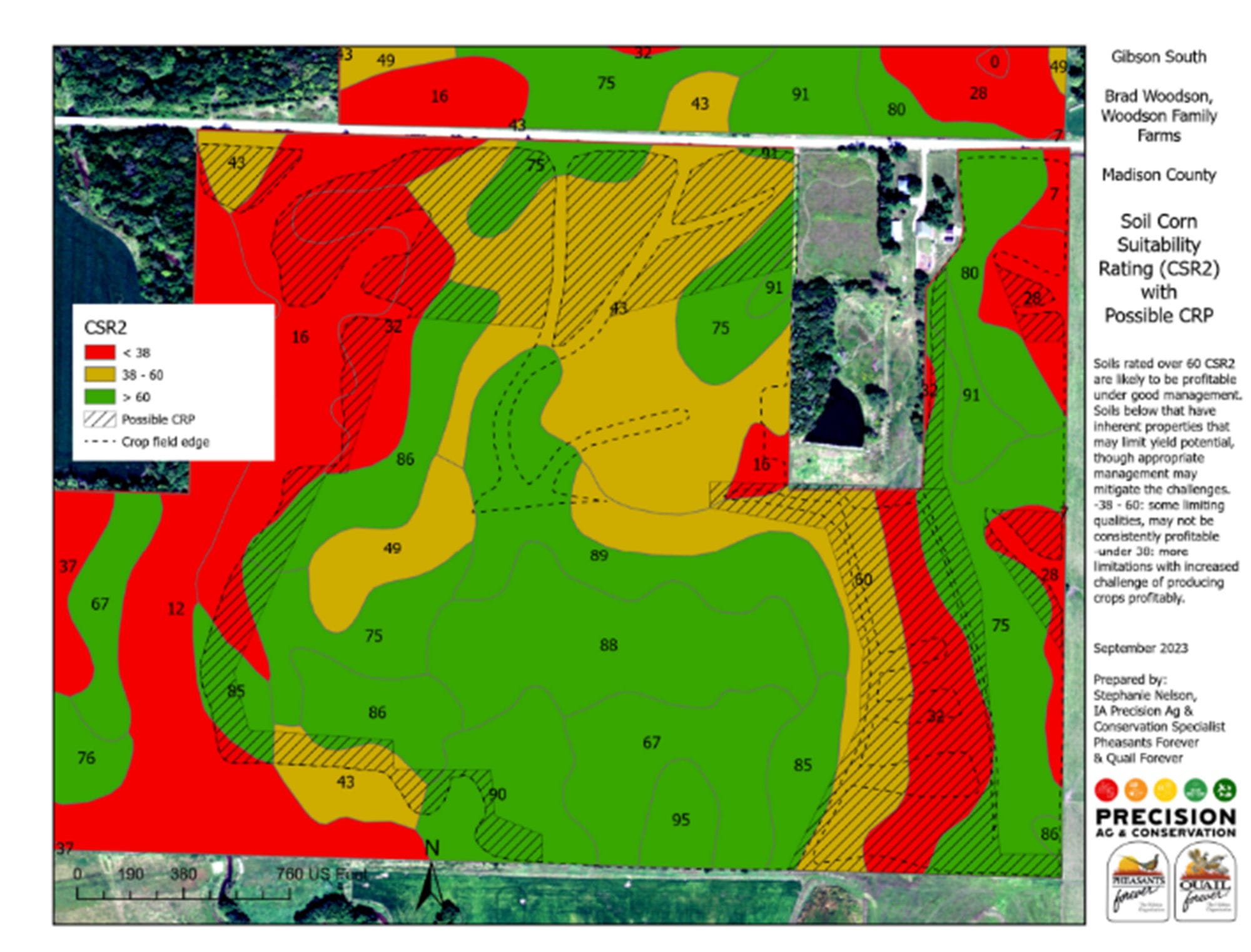
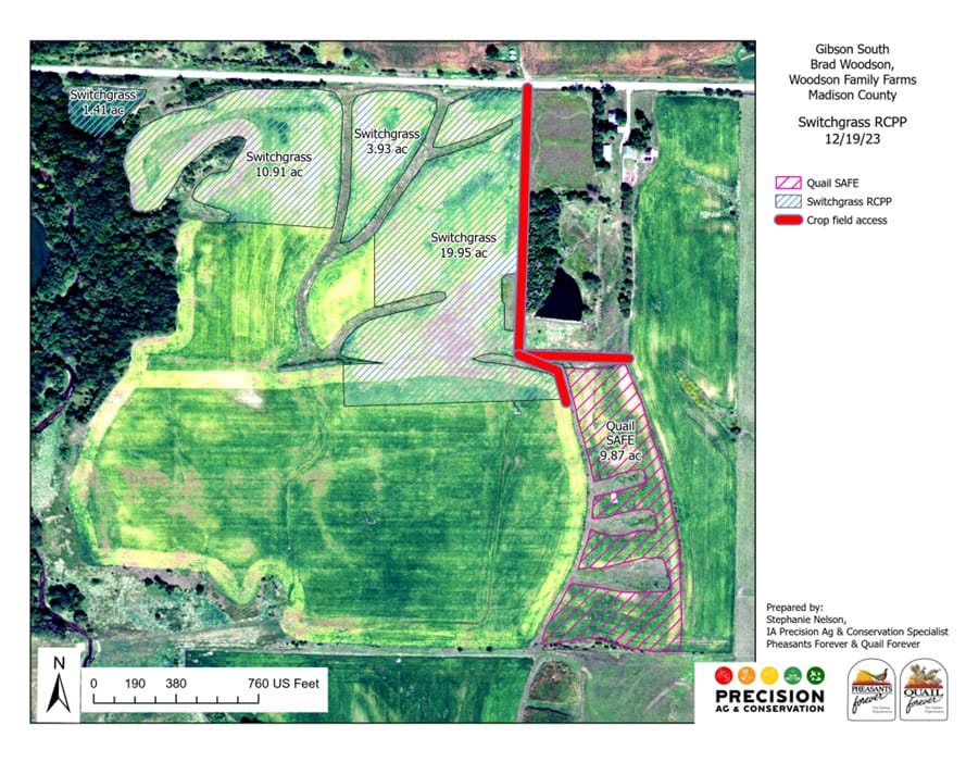
As a landowner in Madison County, Iowa, I love the rolling topography. Crop fields are interspersed with pastures and woodlands with creek corridors connecting all these habitats together. There are a lot of irregular shaped fields and it turns out, a lot of variability in crop yields.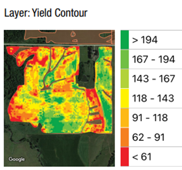
Precision Conservation Analysis
PFI is partnering with Pheasants Forever on a Conservation Innovation Grant with the NRCS. Pheasants Forever uses technology and data, aptly called precision conservation, to analyze field profitability. I met with Stephanie Nelson, a precision ag and conservation specialist with Pheasants Forever, to analyze a farm where I had concerns about persistent low yields and profitability. It is also a farm where I wanted to develop more habitat. Stephanie begins her analysis by using the oldest and most readily available data, which is soil maps. In Iowa, all soil types have been given a CSR2 rating, which is a crop productivity index directly correlated with corn yield; CSR2 stands for corn suitability rating. Using geographic information systems, (GIS) she is able to overlay multiple layers of data including satellite infrared maps called Normalized Difference Vegetation Index (NDVI), topographic maps and lidar (light detection and ranging) maps.